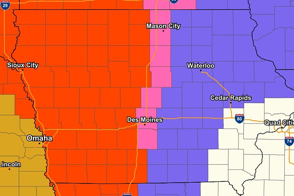
Half of Iowa is in a BLIZZARD WARNING
The western half of the state is in a BLIZZARD WARNING.
The areas included in the Blizzard Warning can expect a total of 4-10" of snow and winds gusting as high as 50 MPH.
The Blizzard Warning will go into effect at 6 PM Thursday through 6 PM Friday.
According to the NWS, a Blizzard Warning means that the following conditions are occurring or expected within the next 12 to 18 hours:
1) Snow and/or blowing snow reducing visibility to 1/4 mile or less for 3 hours or longer
AND
2) Sustained winds of 35 mph or greater or frequent gusts to 35 mph or greater.
There is no temperature requirement that must be met to achieve blizzard conditions.
Areas in and around Waterloo, Oelwein, and Cedar Rapids are in a WINTER WEATHER ADVISORY. The included areas can expect a total of 2-5" of snow along with wind gusts 20-25 MPH. Most of the snow will fall Thursday night into Friday.


EXPECT SNOW TOTALS (as of 5 AM 1/14)

See the Must-Drive Roads in Every State
More From 97.7 KCRR