WINTER STORM WARNING for Eastern Iowa
** info updated at 5:45 AM 1/30***
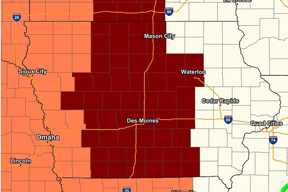
The National Weather Service in Des Moines has issued a WINTER STORM WARNING for portions of Eastern Iowa from 9 AM SATURDAY TO 9 AM SUNDAY.
The NWS says to expect total snow accumulations of 2 to 5 inches and ice accumulations of one tenth to two tenths of an inch in the warning areas.
Expect areas of freezing drizzle or freezing rain to develop Saturday morning over central to northern Iowa. The freezing precipitation is likely to persist and even increase in intensity during the afternoon hours. There will be a period of a wintry mix of freezing rain and snow in the late afternoon into early evening hours before switching over to all snow.
Plan on ice and snow-covered roads. There is the potential for tree limb damage and power outages with the freezing rain potential and the strong winds. Travel will be extremely difficult.
Submit your snow and ice amounts to the National Weather Service HERE.
For the latest road conditions you can call 5-1-1 or utilize 511ia.org.
REMEMBER: Forecasts CAN and WILL change even with the slightest change in movement with the storm! Be Prepared!


LOOK: Famous Historic Homes in Every State
More From 97.7 KCRR