Northeast Iowa Rivers Rising; Storm Clean-up Continues
The clean-up is underway in many areas of northeast Iowa impacted by severe weather on Saturday (June 9, 2018).
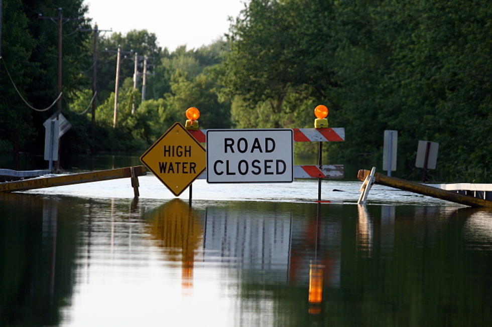
High winds caused damage across the region, while heavy rainfall caused flash flooding that washed out several roads. Now, multiple rivers are on the rise. ***See Flood Warnings Below***.
According to the Iowa Department of Transportation (IDOT), U.S Highway 218/Iowa Highway 27 -- also known as the Avenue of the Saints -- is closed in both directions near Charles City due to downed power lines. Officials shut down a three-mile stretch of the four-lane divided highway between Floyd County Road B-59 and U.S. Highway 18 early Sunday morning so Mid-American Energy crews can make the needed utility repairs.
IDOT officials said the impacted segment of the Avenue could be closed for a two or three days. Traffic was being detoured using Old Highway Road and S. Grand Ave.
There were reports that six- to seven-inches of rain fell in northern Iowa late Saturday afternoon and evening. The National Weather Service said that Waterloo had 2.02 inches, which set a record for June 9 precipitation. The old mark of 1.60 inches was set in 1966.
According to Floyd County Emergency Management officials, many roads in the county were damaged or washed out by flash flooding on Saturday and that Rockford was closed to night-time inbound traffic. Authorities said vehicles were being allowed back into the city Sunday morning.
The storm caused widespread damage in Rockford, Floyd County Emergency Management officials indicated in a Facebook post. Sunday morning, they said an organized clean-up was underway as of 8 AM and authorities were asking for volunteers to cut up trees and haul away debris. They were also encouraging spectators to stay away from Rockford so that clean-up efforts wouldn't be hindered.
Further east, authorities in Delaware County were highly discouraging travel on rural roads. Officials with the Secondary Roads Dept. said many roads -- especially those generally west of a Dundee-to-Manchester line and north of U.S. Highway 20 -- have washed out areas that will need repair. They reported Sunday morning that maintenance crews were out assessing each road for damages and beginning repairs.
Heavy rainfall on Saturday and over the past few days, especially in far northern Iowa, has brought renewed flooding to the region on the 10th anniversary of the historic, record-breaking flood of 2008.
Sunday morning, the National Weather Service updated water level predictions for several northeast Iowa and extended flood warnings that were issued Saturday evening.
Minor to moderate flooding is now forecast along the Cedar River from Charles City to Waterloo-Cedar Falls and further downstream to La Porte City; for the Shell Rock River at Shell Rock; the Upper Iowa River at Dorchester; the Maquoketa River at Manchester; and for the entire Turkey River basin from Spillville downstream to Garber.
- A flood warning is posted for the Cedar River at Charles City through Monday afternoon. Minor flooding is occurring and minor flooding is forecast. The river is expected to rise to near 12.5 feet today, then fall below its 12-foot flood stage this evening. At 9:30 AM Sunday, the stage was 12.2 feet.
- A flood warning for the Cedar River at Cedar Falls continues until Thursday afternoon. No flooding is occurring, but moderate flooding is forecast. The river is expected to continue rising to 92.2 feet, or 4.2 feet above its 88-foot flood stage, Monday evening before cresting. At 9:45 AM Sunday, the stage was 87.7 feet, or 0.3 feet below flood stage.
- A flood warning for the Cedar River at Waterloo downstream to near La Porte City continues until early Wednesday morning. Minor flooding is forecast. The river is expected to reach its 12-foot flood Stage Monday morning, and continue rising to 14.1 feet, or 1.1 feet above flood stage, early Tuesday morning before cresting. At 10 AM Sunday, the stage was 9.5 feet, or 3.5 feet below flood level.
- A flood warning for the Shell Rock River at Shell Rock -- or from near Clarksville downstream to the Cedar River -- continues until Monday evening. Minor flooding is occurring and is forecast to continue. The river is expected to rise to 14.0 feet, or 0.5 feet above its 13.5-foot flood stage, this evening before cresting. At 9:45 AM Sunday, the stage was 13.9 feet, or 0.4 feet above flood stage.
- A flood warning for the Upper Iowa River at Dorchester (Iowa Highway 76) continues until Tuesday evening. Minor flooding is occurring and moderate flooding is forecast. The river is expected to continue rising to near 18.0 feet, before cresting Monday morning. Flood stage is 14.0 feet. At 9 AM Sunday, the river level was 15.1 feet.
- A flood warning for the Maquoketa River at Manchester (U.S. Highway 20) continues until Monday morning. Minor flooding is occurring and moderate flooding is forecast. The river had risen seven-feet between 3 AM and 9 AM Sunday. The water level is expected to rise to 19.8 feet today, before cresting. Flood stage is 14.0. At 9:15 AM Sunday, the stage was 16.9 feet and rising.
- A flood warning for the Turkey at Spillville continue until Monday evening. Minor flooding is forecast. The river is expected to rise above its 9-foot flood stage today and reach 10.9 feet this evening, before cresting. At 9:30 AM Sunday, the river level was 7.8 feet.
- A flood warning for the Turkey River at Elkader continues until Wednesday afternoon. Minor flooding is occurring and minor flooding is forecast. The river is expected to continue rising to near 15.6 feet by Monday morning before cresting. Flood stage is 12.0 feet. At 8:45 AM Sunday, the stage was 13.1 feet.
- A flood warning continues for the Turkey River at Garber until late Tuesday night. Moderate flooding is forecast. The river is expected to rise about its 17.0-foot flood stage today and continue rising to near 21.0 feet by Monday morning before cresting. At 9:15 AM Sunday, the stage was 15.6 feet.
More From 97.7 KCRR