Severe Storms Expected Across Northeast Iowa Tonight
A quiet, sunny afternoon is setting the stage for an active weather night across northeast Iowa.
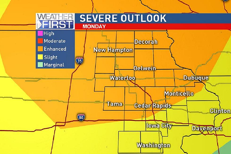
According to the National Weather Service, there is an enhanced risk of severe storms developing in the early evening hours on Monday. Severe thunderstorms are possible across the area late this evening and tonight.
Heavy rain, lightning and damaging wind gusts are the primary threats with these storms. The risk of large hail and tornadoes is low, but both are a possibility.
The highest chance for severe weather comes after 6 PM, CBS2 Meteorologist Rebecca Kopelman said. However, there could be a few stray storms this afternoon.
According to Kopelman, a cold front is expected to spark a line of thunderstorms as moves from north to south across Iowa. The region should be clear by midnight.
The severe threat will dwindle the further south the storm moves.
Source: CBS2
More From 97.7 KCRR